
The mountaintop of Bergvattenberget with its steep cliff at a hight of 120 meters, is a mythical place that is commonly known as “Offerhällan”. The mountaintop is a vantage point in the village Sörnoret. It is said to have been a holy place for the Saami, but is also, as described, a very good vantage point, from where the reindeers could be located.
There are myths about what should have happened at the top of the mountain. At such a high located place, it was usual for the Saami to sacrifice some of what they had hunted and captured, like meat and fish. According to the Saami belief, to be at a place closer to the sky meant to be closer to the gods. The sacrifices might have been made in hopes of better lives or a fortunate hunt.
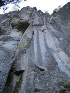
Photo: Christian Ortner
The top of Bergvattenberget is reacht along a hiking path that starts beside a graveled road. The path therefrom runs along footbridges over a bog and through the pine forest that grows on the sides of Bergvattenberget. The hiking path is quite short and relatively easy to walk with the footbridges over the bog. However, the path contains a elevation of 120 meters with some steeper parts. After a few hundred meters, the path splits into two. Both of these paths leads to the mountaintop, but have different lengths.
Från toppen av Bergvattenberget erbjuds en fantastisk utsikt över de kringliggande vattnen och skogarna. Där finns också en eldstad med vindskydd. För den som vill elda rekommenderas egen ved att medtas. Viktigt: Ta med ditt skräp hem, lämna platsen i fint skick efter du har besökt den.
Utkiksplatsen är inringad av staket mot stupet. Området beträdes dock på egen risk. Därför uppmanas försiktighet att vidtas och att noggrann uppsikt hålls över medföljande barn.
The hiking path ends at the a cliff at the top of Bergvattenberget, from where the visitor has a stunning view over the surrounding waters and forests. The mountaintop is also provided with a wind shed and a fireplace. Those who wants to light a fire, is however recommended to bring their own firewood.
Please note
A fence has been placed at the edge of the cliff, but that the area is to be visited at one’s own risk. We therefore recommend caution and to keep a close eye on accompanying children.
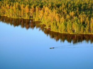
Photo: Christian Ortner
How to get here:
Parts of the road toward Bergvattenberget consists of a narrow gaveled road. We therefore recommend to drive carefully.
- From Åsele center, drive along Skolgatan towards the golf course, parallel to road 92.
- Drive through the village Söråsele, pass the golf course and continue towards the village Sörnoret.
- After 14,6 kilometrs, make a right turn. There you will find a road barrier.
- If the barrier is open, drive along the side road for 1 kilometer until you reach the start of the hiking path where the car can be parked.
- If the barrier is closed, park the car along the road you came from and continue for 1 kilometer by foot to the start of the hiking path.
- The hiking path is marked with signs and will be on your right hand side.
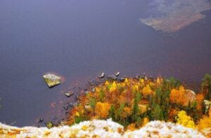
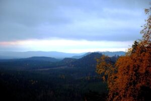
Photo: Christian Ortner