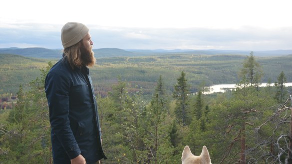
The ecopark Käringberget is a nature area that offers breathtaking views of the stunningly beautiful landscape as well as intriguing cultural stories. From the vantage point of Käringberget one can admire the varying landscape that lines the flowing water of the river Lögdeälven while reflecting over all the people and lifestyles that have existed among the old pines on the mountaintop. If lucky one can also catch a glimpse of a black grouse at the top of the trees or a golden eagle that floats over the ancient landscape.

Photo: Lin Kleiven
Flora and faun
The flora in the ecopark consists of a deciduous forest of varying age as well as old coniferous trees. In many areas the landscape is dominated by young birch wood and at the mountainsides an old deciduous forest of aspen and sallow creates a pleasant residence for bird spicsies such as black grouses woodpecker and grey-headed woodpecker. However, an old forest draped in bear moss rises at the northers side of the mountain, which creates an eerie contrast of the landscape.
Down by the river Lögdeälven the deciduous forest benefits from the yearly spring floods. The nutritious residue of the spring rivers enable the survival of many demanding plants in the area. The floods of the river Lögdeälven is unregulated since the river is one of few forest rivers in Sweden that remains undeveloped. This fact has given Lögdeälven a position in the EU-network of Europ’s most protection worthy areas since Natura 2000.
Another protection worthy part of the ecopark Käringberget is the old pine trees that stands high on the mountaintops in the area. The majority of the old pine trees carries traces of fire damage on their tree trunks that marks their survival after forest fires from ancient times. The state of the pine trees makes them to important resources in the landscape, for instance for bugs that lives in their tree trunks.
The pine trees stands tall on the mountaintops of the mountains in the ecopark. Many of the mountains have a height of over 400 meters and the highest of them is Käringberget with its 506 meters. The types of rock in the area mostly consists of reef granite core granite and metagråvacka. The soil in the other parts of the ecopark is dominated by moraine with elements of peat. This does not include the river Lögdeälven, where ice-river sediment is spread.

Photo: Christian Ortner
What to see and do
The varying nature of ecopark Käringbärget can be experienced along not less than three hiking paths.
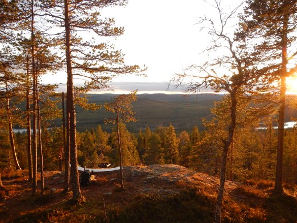
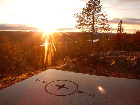
Ekoparksleden is 2,4 kilometers long and runs through the deciduous forest up the mountain Käringberget in to the old pine trees on the mountaintop. A fireplace and a stone bench is located where the hiking path ends, from where the visitor has a stunning view over the woods of the ecopark and the flowing water of Lögdeälven.
The hike along Ekoparksleden goes uphilll along Käringberget that rises 506 meters over the sea. Therefore are proper hiking boots recommended. Visitor who wants to make a fire at the vantage point at the top of the mountain, must bring their own firewood. We do also recommend visitors to bring something to lay on top of the stone bench, since the stone bench is cold to sit on all year round.
Vildmarksleden is a more flat leveled hiking path. This hiking path starts at a hanging bridge that takes the hiker over the water of Lögdeälven. The path then continues along the river side through the beautiful river landscape.
Isälvsleden does, as well as Vildmarksleden, offer a view over the river Lögdeälven. This short hiking path starts at Gammelgården (the place where the first settlement was built) and runs along a ridge next to Lögdeälven. From the top of the ridge, the visitor has a lovely view over the river and the surrounding nature.
For the one who strays away from the hiking paths there are other treasures than the stunning views to discover. During the autumn one can bring a basket to collect berries and/or edible mushrooms in. The ecopark has a rich supply of blueberries, lingonberries and cloudberries as well as porcini mushrooms and chanterelles. If lucky, one can also find matsutake, one of the most expensive edible mushrooms in the world, that grows on the dry pine moors of the ecopark.
Besides berries and edible mushrooms. Käringberget offers the possibility to hunt and fish. Fore those interested in fishing, the lakes of the ecopark offers grayling, trout and planted rainbow trout. Fishing cards are administrated by Sveaskog. Sveaskog are also responsible for the landscape conservation in the ecopark. Click here to read more about the fishing cards.
The wild game area of the ecopark is in turn leased by the Fredrika-company Naturupplevelser Viska, who arranges hunts of forest birds and beaver among other things in the area. Click here to read more about the hunt in the area.
Other attractions offered by the ecopark Käringberget are:
- The bird pond: the pond is located in the northern parts of the ecopark on a large, open bog. The pond is visited by many bird spicies, thereamong ruff, golden-eye, garganey and wooper swan.
- The runway: the runway that is located next to the river Lögdeälven has for years been used by airplanes for forest management in the area. Today there is a resting area next to the runway where visitors can take a brake from their car drive.
- Konstvägen sju älvar: the art road seven rivers that leads through the ecopark Käringberget were created by the artist Kari Cavén and consists of twelve art pieces that are placed alongside 350 kilometers of road 92. The art road beginnig in Holmsund in the east and ends in Borgafjäll in the west.
- The cultural-environment path: at this path the visitor traveles by car through the ecopark. The path was created as part of the KING2-projekt (Kulturarvet i Nordskandinaviska Gammelskogar).

Photo: Christian Ortner
Culture
The ecopark Käringberget is a nature area filled with history. Some of the cultural heritage of the area consists of unmistakable elemenst of the beautiful landscape, while others are more hidden undernieth the furface, braided in to the tales to only be sensed by the visitor through the names of the mountains and lakes of the ecopark.
One of the visible cultural elements of the ecopark is the remains of the catching pits that were used to hunt moose in the area. The catching pits have peen flattened over the years, but when they were used, they had a depth of about two meters with vertical sides. Sometimes stakes were placed at the bottom of the catching pits to pierce the animal that was chased in to the pit. The hunt with catching pits was forbidden in 1864 and today their remains are concrete interruptions in the landscape.
Another, even older, but les noticeable cultural element in the nature of Käringberget, is the occurrence of shard stones. These stones were heated to such temperatures that they cracked and turned porous. Such heating was made by humans between 3800 and 2599 years ago during the era that in large is called the Bronze Age. At this point in time the characteristic culture of the Bronze Age had not yet spread to the northern parts of Sweden, whereby the people here still used methods of the Stone Age. The occurrence of shed stones along the river Lögdeälven is therefore remains from settelments of the Stone Age.
Along the river there are also younger cultural remains. Dams as well as piles of rocks are remains after the timber rafting that was operated from the mid 19’th century to the 1970´s. Through the timber rafting large tree trunks were transported from the inland to sawmills at the cost.
Yet another cultural element in the nature of the ecopark is the Sami extraction site of bark that was found during an inventory of the natural values of the area. The extraction site consists of traces on pine trees that are believed to have been caused by extraction of the pine bark. The extraction of the pine bark was done through removal of the bark on the north side of the pines. the point of this process is believed to have been the access of the inner bark that was used for many purposes, including for food.
The pine forest of the ecopark has in other words for a long time been an important recourse for people in the area. Between the 16’th and 20’th century, the pines were used for the production of tar, which was used to impregnate tree constructions. in the 17’th and 18’th centuries tar was Sweden’s the leading export product and Västerbotten stood for the majority of the tar production in the country.
The tar was extracted in “tar valleys” at different locations in Västerbotten. Along the northern side of Lögdeälven lies the remains of a large tar valley that was used during the period. There is also a reconstruction of a tar valley that was built in the 1990’s. The reconstruction allows the visitor to catch a glimpse of what life was like in the ecopark a couple hundred years ago.
A more subtle part of the cultural history of the ecopark Käringberget does also have its roots in the pine forest and the tar valleys. In the east part of the ecopark lies the lake Tjärekallsjön that is said to have gotten its name due to an incident connected to the tar valleys. At the end of the 19’th century a “tjärbrännare” (a worker at the tar valley) in the area should have entered into a contract with a buyer of the tar that should be extracted at the tar valley during the season. When the sale took place the buyer however lowered the offering price to half of what was agreed. This should have made the tjärbrännare so angry that he in his rage emtied the tar into the lake instead of selling it to the buyer. This action should have had devastating consequences for the fish population in the lake.
Perhaps the angry tjärbrännare lived in a homestead in the area around the ecopark Käringberget. Homesteads were built in the area from the later part of the 18’th century when the state provided land in the area in order to attract more people to settle in the sparsely populated northern areas of Sweden and thereby in the long run increase the tax liability from the growing number of homesteads. The very first homestead was built by Lars Persson Fridahl and his wife Maria Johansdotter after that Lars had been fired from his position as dragoon. The homestead should have stood where the house Gammelgården stands today. A memorial stone has also been raised there in memory of the first settlers in the area.
From the end of the 19’th century the state changed its leasing of the land to only allow crofts (so called kronotorp). The crofts were more limited in size and consisted of small farming plots that were leased in crown parks in to the 1930’s. The change was a result of that more people had moved to the sparsely populated areas an that the attraction of more settlers no longed was seen necessary.
In the 1950’s the growing population recuired new roads around the ecopark. Therefore the Jaundice road was built during the 1950’s. The name of the road comes from the fact that almost every worker got the sickness during the construction of the road. The Jaundice road is one of the more subtle parts of the cultural history in the ecopark.
Other names of places in the ecopark Käringberget that carries their own histories that are not told above are Fäbodberget, Middagsberget, Mittiberget and not least Käringberget itself.
How to get here:
The ecopark Käringberget is located along road 92, a 16 minute drive from Fredrika. The parkinglot of the ecopark is easiest to find with help of its coordinates. The start of Ekoparksleden that leads up to the vantage point at the top of Käringberget, can also be found in this way.
- From Åsele, drive for about 70 kilometers along road 92 towards Umeå.
- About 20 kilometers southwest of Fredrika, road 92 will crodd the river Lögdeälven. After the bridge, there is a rest area with information boards about the ecopark Käringberget.
- Follow the instructions on the information boards to continue into the ecopark.
